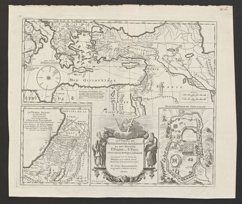
Les voiages de notre seigneur Jesus Christ
Map Maker/Publisher/Engraver: Moullart Sanson
Date: 1712
Size: 36,4 x 43 cm
Striking and hightly detailed copper engraved map showing the journeys of Jesus Christ in Holy Land and the travels of St. Paul and St. Pieter from Holy Land to Italy. The title cartouche is in the lower centre and shows Christ entoured by St. Pieter (to the left) and St. Paul (to the right). Two insets are in the lower corners: 1- “La Terre Sainte où sont observés Tous les Lieux dont il est parle dans le Nouveau Testament (qui n’ont pu etre miss dans l’autre Carte)”, 2 – “Plan de la Ville de Jerusalem”. Map adorned with a large wind rose.

