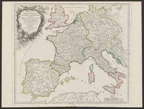
Imperium Caroli Magni Occidentis Imperatoris
Map Maker/Publisher/Engraver: Gilles Robert De Vaugondy, Didier Robert De Vaugondy
Place/Date: Paris/1752
Size: 56,6 x 48,5 cm
Attractive and detailed map of Charlemagne's empire, covering the British Isles, Denmark, the Low Countries, Germany, France, Spain, Switzerland, Austria, Italy, Hungary, Poland, the Balkins, Greece, etc. Large Decorative cartouche.

